solution(180)
Galaxy Software Services Corporation
486
0
E-Office
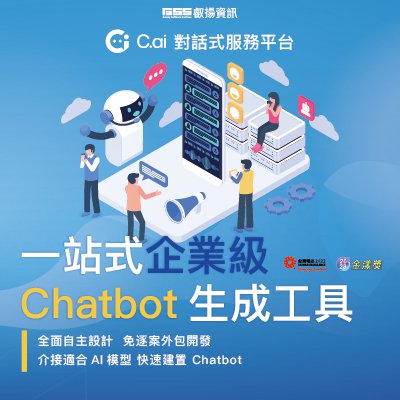
C.ai
C.ai: Conversational service platform is recommended as the best autonomous solution for enterprises to implement LLM intelligent assistants and related applications. It features easy editing with No-Code/Low-Code, easy integration with internal and external systems, and a complete service interface. With LLM application compliance and governance, enterprises can choose to integrate various suitable language models to enhance AI implementation capabilities. It supports various communication software and browsers, completing design and launch in one stop.
Ministry of Economic Affairs
3.14k
0
Smart Governance
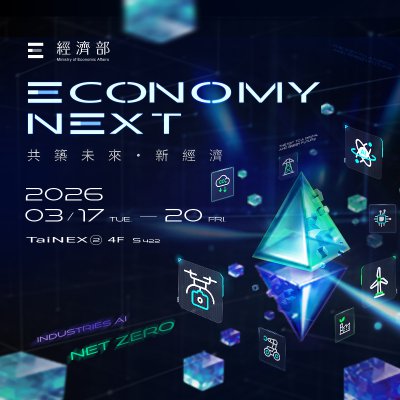
Economy Next
Under the theme “Economy Next,” the Ministry of Economic Affairs presents dual pavilions on AI and net zero, illustrating Taiwan’s vision for dual transformation. The Net Zero Pavilion showcases resilient green energy systems and low-carbon supply chains, while the Industries AI Pavilion highlights advanced technologies and smart applications that delivers concrete solutions across industries in hope of fostering collaboration opportunities with global partners.

SynaiQ CO., LTD
401
0
AI / AIoT
Smart City Online – Customized AI Solutions & System Integration
This solution provides customized AI model development and system integration services for governments and enterprises with existing systems and data. SynaiQ delivers end-to-end support, including consulting, LLM design, deployment, and long-term maintenance. The modular and scalable architecture reduces barriers to AI adoption while enabling organizations to build sustainable, flexible, and future-ready intelligent systems.
Far EasTone Telecommunications Co., Ltd.
1.01k
0
Smart Building
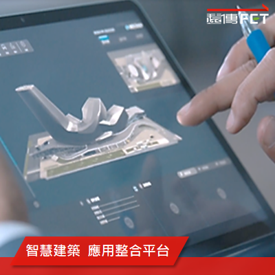
Smart Building Integration Services
Leveraging its strong telecommunications and ICT integration expertise, Far EasTone delivers comprehensive smart building solutions for modern, data-driven environments. With a reliable fiber backbone, 4G/5G and Wi-Fi networks, and IoT technologies, Far EasTone seamlessly connects on-site sensors, surveillance, access control, and environmental systems to create a secure and resilient data infrastructure.
By adopting open communication protocols, Far EasTone enables cross-system integration, consolidating previously fragmented power, fire safety, HVAC, and low-voltage systems into a unified building management platform. This ensures intelligent centralized monitoring and coordinated operations across all building systems.
The platform offers real-time monitoring, data analytics, operations and maintenance management, and AI-powered Digital Twin visualization. It empowers building owners with full lifecycle visibility, reduces energy consumption, enhances operational efficiency, and delivers safer, smarter, and more sustainable buildings.

LIGHTSPEED International Co.
750
0
5G Telecommunication
Lightspeed International Co. Provides faster stable router for Smart City solution
LIGHTSPEED is specialized in communication for 31 years up to 2025.
All engineers has more than 20 years' experience in Modem, Router, 5G gateway, & LoRaWAN ChirpStack Gateway design.
Product lines cover 5G,4G, 3G, WiFi 6,WiFi 7 router, Serial/IP gatway,, 4G/3G IP CAM, modem, 4G miniPCIe card, 802.11ah HaLow 4G gateway, LoRaWAN ChirpStack Gateway, WIFI 802.11n/g/b/ac/ax/be miniPCIe with USB interface, outdoor 5G +wifi router, tracker, 4G security guard/police video surveillance recorder and server, as well as cloud service.
We also provide ODM/OEM service for special requirements, such as multi-SIM card failover system, multiple channel aggregation, cell tower tester..etc
Chunghwa Telecom Co., Ltd.,
594
0
ESG
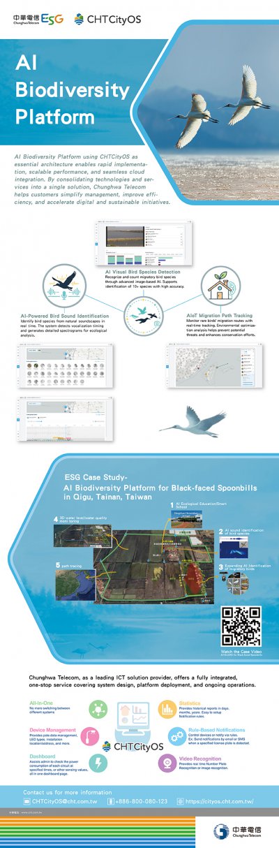
AI Biodiversity Platform
AI Biodiversity Platform using CHTCityOS as essential architecture enables rapid implementation, scalable performance, and seamless cloud integration.
By consolidating technologies and services into a single solution, Chunghwa Telecom helps customers simplify management, improve efficiency, and accelerate digital and sustainable initiatives.
Chunghwa Telecom as a leading ICT solution provider, offers a fully integrated, one-stop service covering system design, platform deployment, and ongoing operations.

Qualcomm Incorporated
537
0
AI / AIoT
Qualcomm® Insight Platform
The Qualcomm Insight Platform (QIP) delivers an end-to-end video intelligence solution powered by Qualcomm Technologies’ industry-leading on-device AI. It provides centralized video intelligence management across diverse sources and leverages real-time edge AI analytics to reduce latency and accelerate decision-making. A built-in multimodal AI engine integrates image, speech, and text capabilities while optimizing performance, security, and total cost of ownership (TCO) for stable and highly scalable deployments.
Paired with Innodisk’s edge AI box and IP cameras, QIP enables high-efficiency real-time edge analytics, supporting multimodal AI and natural language search while integrating seamlessly with existing infrastructure. It enhances worker safety, optimizes logistics processes, and strengthens restricted area management, helping organizations improve operational efficiency and risk control. The platform transforms surveillance into actionable security and operational insights with built-in privacy and compliance while ensuring data privacy and regulatory compliance. It is suitable for smart cities, manufacturing, energy and utilities, warehousing and logistics, retail and commercial spaces, healthcare and education, transportation, as well as enterprise and building management scenarios.
* Qualcomm branded products are products of Qualcomm Technologies, Inc. and/or its subsidiaries. Qualcomm is a trademark or registered trademark of Qualcomm Incorporated.
意藍資訊股份有限公司
2.56k
3
AI / AIoT
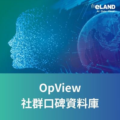
OpView
OpView is the largest Social Listening platform in Taiwan, offering a comprehensive data analysis tool that enables real-time public opinion monitoring. Leveraging cutting-edge AI-powered Semantic Analysis and Search Engine technologies, OpView delves into a vast pool of 10 billion Chinese characters collected daily to extract meaningful social insights.
Our platform excels at capturing trends and community dynamics, delivering enterprises with valuable information to stay ahead of the curve.
HAMASTAR TECHNOLOGY CO., LTD.
631
1
Smart Transportation
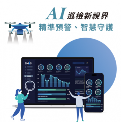
Smart Mobile Inspection System
Across urban and industrial environments, public facilities, critical assets, and infrastructure systems are often highly complex and geographically dispersed. Even minor abnormalities, if not identified and addressed in time, can lead to safety risks and operational disruptions. The Smart Mobile Inspection System is designed to address these challenges, enabling governments and enterprises to establish forward-looking digital inspection and maintenance management capabilities.
The system integrates mobile devices, sensor data, and visual information, leveraging real-time AI analysis and anomaly detection to transform potential risks into predictable, traceable, and actionable management tasks. From anomaly alerts and intelligent task assignment to on-site reporting and final verification, the platform seamlessly connects every stage of the inspection workflow, delivering a fully digital, end-to-end inspection and maintenance management solution.
AIRA Corporation
2.63k
0
AI / AIoT
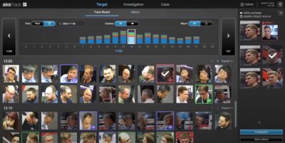
airaTrack- Facial Tracking Solution
airaTrack is a comprehensive personnel tracking system that utilizes AI algorithms developed by our team to extract features from both the "face and figure." It generates unique biometric IDs with a recognition accuracy of up to 99%, all without the need for registering facial data, addressing privacy concerns. Capable of cross-camera searches and matching 10,000 faces per second, it significantly enhances the efficiency of traditional manual matching processes and increases search efficiency and accuracy by 97% enabling automatic path tracking of personnel in the field. The system also generates investigation reports for evidential preservation.

Climate Change Administration,Ministry of Environment
2.55k
1
Circular Economy
Transforming Textile Waste into Sustainable Recycled Materials
Strong and Wise Materials Technology offers a solution for transforming textile waste into high-value products, promoting low-carbon sustainability and environmental protection. Not only does this solution address the pollution caused by textile waste in urban areas, but it also aids brands and the textile industry in managing over 90% of their textile waste.
Through patented technology, we convert textile waste into high-quality recycled plastic (R-PET) particles for various recyclable plastic products. Additionally, we produce environmentally friendly green building materials (EF Wood) suitable for different environments, resolving issues associated with solid wood and plastic wood while creating a variety of wood-like furniture. All our products are 100% recyclable.
Strong and Wise provides truly sustainable and circular solutions, generating renewed value from textile waste.
StarTrust System Inc.
2.28k
0
Net Zero Innovation
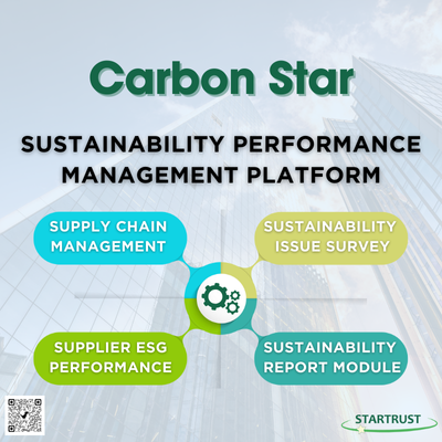
Sustainability Performance Management Platform
The Sustainability Performance Management Platform assists enterprises in extending their management perspective from direct emissions to the entire value chain, ensuring the precise implementation of supplier sustainability performance management. The system features a comprehensive digital survey and data management platform, covering everything from questionnaire design, distribution, and response collection to multi-level approval and statistical analysis, enabling companies to integrate supply chain data with maximum efficiency.
With flexible template design and year-over-year comparison tools, enterprises can track trends in key issues in real-time. The system supports diverse data entry methods and automated chart generation, while also offering seamless integration with sustainability reporting systems to enable automatic data updates. By leveraging this digital system, companies can establish a highly traceable data management process and significantly strengthen supply chain resilience.
Core System Features:
1. Supplier and Stakeholder Performance Assessment: Digitally collect and audit various ESG indicators.
2. Automated Statistical Analysis and Comparison: Generate real-time visual reports to track annual performance trends.
3. Data Integration and Report Linking: Streamline data aggregation to accelerate the production of sustainability reports.
 、Firefox
  、Edge
、Edge  瀏覽器!
瀏覽器!