solution(180)
A-MTK Co., Ltd.
2.73k
1
Smart Transportation
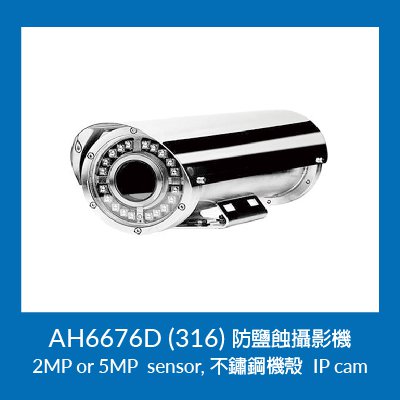
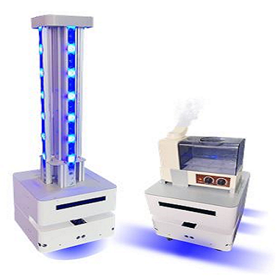
A-MTK anti-salt corrosion IP came series can be used in coastal patrol, port authorities, and waterfront tourist spots. These locations are close to t
3. High-end line: full system is 307 or 316 stainless steel chassis. Model No.: AH6676D (316)
- Successful Case: Installed at the perimeter of Taipower Plant, an offshore area.
- Sony Starvis™ sensor with 2MP, 5MP resolution.
- Different angle lens are available. IR LED range is up to 40 meter.
Ability Intelligent Corporation
873
0
Smart Transportation
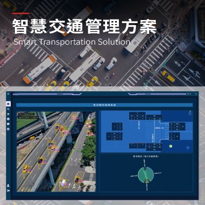
Smart Transportation Solution
Detect Traffic Anomalies Quickly. Minimize Risk.
Traffic risks arise suddenly and unpredictably, challenging traditional monitoring systems to detect them in real time. With advanced AI-powered video analytics and intelligent event detection, Ability Intelligent delivers real-time, automated identification of traffic anomalies—capabilities that exceed traditional monitoring—by instantly flagging vehicle stoppages, wrong-way driving, congestion, pedestrian intrusions, and other unexpected incidents, all accompanied by visual alerts for actionable intervention.
The system proactively identifies abnormal conditions and potential risks, helping traffic authorities shorten response times, prevent incident escalation, and strengthen overall road and public space safety. Ability Intelligent empowers safer, resilient urban transportation with proactive technology.
MiTAC Information Technology Corp.
7.34k
2
Smart Transportation
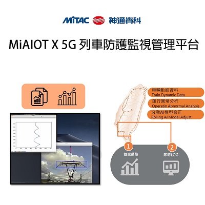
MiAIOT x 5G Railway Safety Management System
The “MiAIOT x 5G Railway Safety Management System was developed based on MiTAC’s in house AIoT platform-“MiAIoT”, and will assist the digital transformation of Taiwan's rail industry in the future, including cloud-based train operating data exchange, real-time train warning system, AI equipment abnormality prediction, and feeding all these crucial information to a situation “war room”.
Galaxy Software Services Corporation
431
0
E-Office
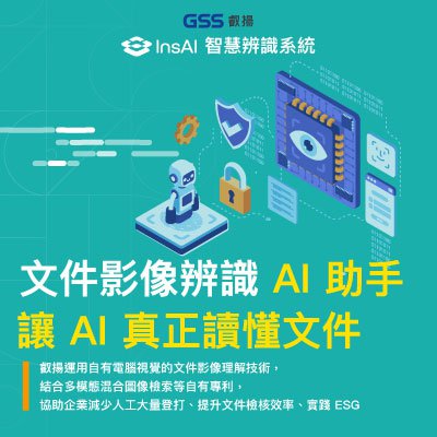
InsAI
InsAI: Beyond Traditional OCR.
InsAI is an intelligent recognition system that allows AI to truly read and understand real-world documents. By utilizing GSS’s proprietary Computer Vision and patented multi-modal retrieval technologies, InsAI transforms document processing. We help enterprises eliminate repetitive manual entry and streamline verification, paving the way for paperless operations and ESG compliance.
TECO
3.82k
1
Smart Transportation
Smart Warehouse Operation Management Solution
• Features:
With integrated AI-based image recognition, ultra-wideband (UWB) wireless positioning systems, warehouse management systems, and cloud platform services, the solution features automatically, real-time, and intelligent benefits to assist enterprises to achieve smart logistics and digital transformation with the enhancement of management efficiency and energy sustainability.
• Functions: The solution includes AI-based image storage location identification, dynamic vehicle dispatching, automatic route planning, and display of available storage space.
• Benefits:
Higher management efficiency: Increases the inventory management efficiency by reducing the warehouse order pick up time by 12% on average.
Energy sustainability: The system is estimated to save more than 6000 kg of annual carbon emissions for a single warehouse.
Environmental benefits: Reduce 12% Warehouse order pick-up time, as well as an estimated annual carbon emission reduction of 6000 kg for a single warehouse.
Galaxy Software Services Corporation
452
0
E-Office
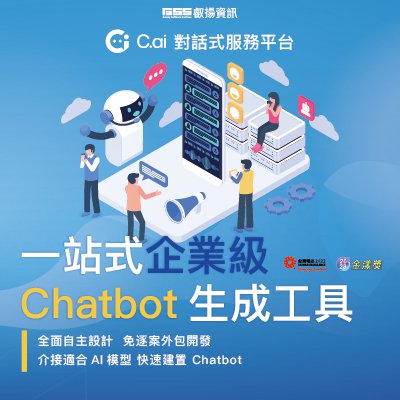
C.ai
C.ai: Conversational service platform is recommended as the best autonomous solution for enterprises to implement LLM intelligent assistants and related applications. It features easy editing with No-Code/Low-Code, easy integration with internal and external systems, and a complete service interface. With LLM application compliance and governance, enterprises can choose to integrate various suitable language models to enhance AI implementation capabilities. It supports various communication software and browsers, completing design and launch in one stop.
Taiwan AI Cloud Corporation
434
0
AI / AIoT
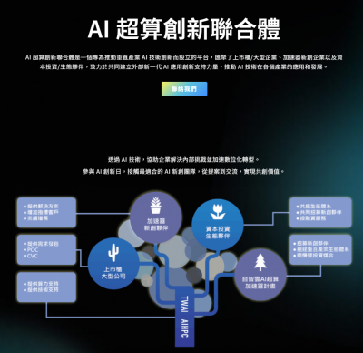
Taiwan AI Cloud AIHPC Accelerator
An acceleration platform that provides AI partners with comprehensive upgrades in technology, products, and markets.
Since 2021, Taiwan AI Cloud has launched the “AIHPC Accelerator” to foster a collaborative AI ecosystem. The AIHPC Accelerator program is designed to support AI startups in matching with smart application scenarios and commercializing their products.
By complementing the roles of third-party accelerators, incubators, and startup support centers, Taiwan AI Cloud provides a comprehensive business development platform for Taiwan’s AI startups. Within just one year, the program achieved outstanding results, signing partnerships with more than 60 startups.

Far EasTone Telecommunications Co., Ltd.
28.57k
2
5G Telecommunication
5G Telemedicine Solution
Leveraging world-class 5G and advanced technologies, FET has built a “5G Telemedicine Platform” to deliver mobile, zero-day telemedicine services. This year, 5G telemedicine has expanded to 15 counties and 59 districts. During the COVID-19 pandemic, we also supported hospitals in providing remote clinical services and maintaining routine medical care.
Features
Real-time telemedicine services to strengthen medical resources in remote areas
Support for medical IoT devices
High-level system integration with hospital workflows
Newly introduced patient functions to meet epidemic-related demands
AI-powered analysis to assist physicians in diagnosis
Full-time video recording to ensure doctor-patient trust and information security
Support for virtual NHI cards
Awards & Certifications
• 2026 Taiwan Excellence Award – The highest honor for product innovation and superior quality
• 2025 National Industrial Innovation Award – First telecom company to win in 18 years
• 2025 Yang Award – Sole telecom winner for smart healthcare innovation
• British Chamber of Commerce in Taipei – Better Business Award 2025
• Certified with U.S. HIPAA for global data security compliance
• Holds ISO 27001, ISO 27017, ISO 27018, and ISO 27701 certifications
Metal Industries Research & Development Centre
2.43k
1
Other
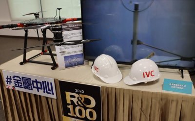
UAV Intelligent Inspection System
MIRDC’s continuously Rotating Wind Turbine UAV Inspection System can effectively inspect the working wind turbine without interference. It takes 5 minutes to complete the inspection of a single blade to effectively detect 4mm small cracks. The system will not lose power generation by turning off the wind turbine, further observes the actual movement status of running blade structure and pillars to grasp the defects beforehand.
Chunghwa Telecom Co., Ltd.,
551
0
ESG
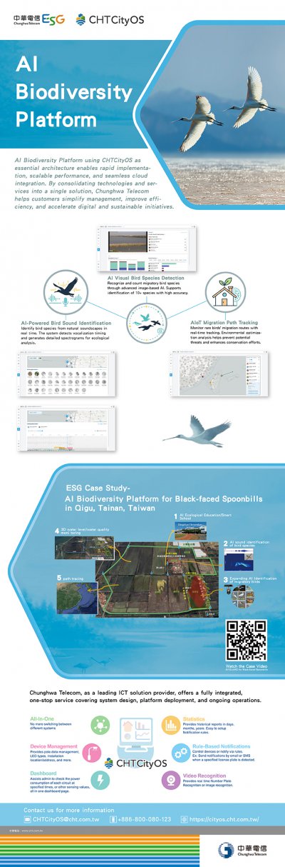
AI Biodiversity Platform
AI Biodiversity Platform using CHTCityOS as essential architecture enables rapid implementation, scalable performance, and seamless cloud integration.
By consolidating technologies and services into a single solution, Chunghwa Telecom helps customers simplify management, improve efficiency, and accelerate digital and sustainable initiatives.
Chunghwa Telecom as a leading ICT solution provider, offers a fully integrated, one-stop service covering system design, platform deployment, and ongoing operations.
e-Formula Technologies, INC
2.77k
0
AI / AIoT
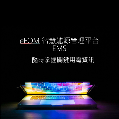
eFOM/EMS
A large number of commercial data are collected through object sensing technology, and the cloud-based visual interface and telecommunication operation surface data are used to assist enterprises to remotely manage the electricity consumption of buildings, manufacturers, business locations, and various branches in real time.
HAMASTAR TECHNOLOGY CO., LTD.
1.68k
0
Smart Manufacturing
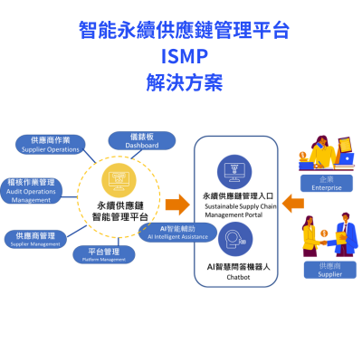
Intelligent Supply Chain Management Platform
Powered by AI, this platform provides businesses with compliance management, risk intelligence analysis, and data-driven sustainable supply chain resilience, enabling them to effectively manage their supply chains.
 、Firefox
  、Edge
、Edge  瀏覽器!
瀏覽器!