solution(180)
CoCoTree
1.91k
2
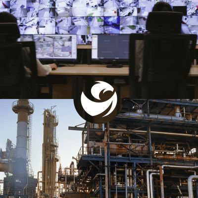
ESG
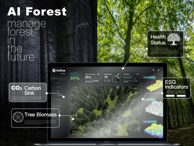
AI Forest collaboration Platform
Through matchmaking of public and private forests, enterprises can acquire forest-related data through hosting mechanisms. This includes metrics such as survival rate, tree height, carbon sequestration, and corresponding SDGs (Sustainable Development Goals) indicators. Leveraging deep learning and image processing technology, CoCoTree transforms trees and forest landscapes into data, providing customers with highly accurate forest information. This includes metrics such as carbon emissions, tree growth status, and changes in the ecosystem.
Join It Sustainable Tech.Co.,Ltd.
436
0
Solar Energy
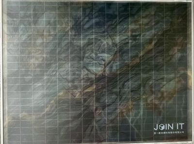
Color-painted Solar Panel
Join It Sustainable turns building façades into power-generating surfaces with a circular, eco-friendly painted PV coating—blending renewable energy with architecture and branding. The coating is anti-soiling, scratch-resistant, rain self-cleaning and designed to reduce glare, while keeping PV performance. Applicable to façades, balconies, carports, shading elements and signage to unlock more renewable area for retrofit and net-zero buildings.
Taiwan’s first public demonstration of a color-painted PV façade: showcased at the Architecture and Building Research Institute (ABRI,MOI), Ministry of the Interior. Phase I & II results prove façade PV can be safely and stably deployed on existing public buildings—turning decorative cladding into a consistent, power-generating building envelope.
SynaiQ CO., LTD
399
0
AI / AIoT
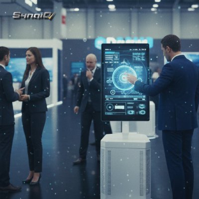
Smart City Online – Customized AI Solutions & System Integration
This solution provides customized AI model development and system integration services for governments and enterprises with existing systems and data. SynaiQ delivers end-to-end support, including consulting, LLM design, deployment, and long-term maintenance. The modular and scalable architecture reduces barriers to AI adoption while enabling organizations to build sustainable, flexible, and future-ready intelligent systems.
Climate Change Administration,Ministry of Environment
2.37k
0
Circular Economy
UKL ENTERPRISE CO., LTD.
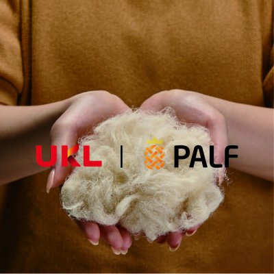
PALF is committed to developing eco-friendly textile products by using recyclable, zero-carbon emission agricultural waste "Pineapple Leaf" to establish the first localized sustainable yarn and fabric pilot production line in Taiwan. We promote the recycling of waste materials to create a more environmentally friendly, sustainable textile and fashion industry.
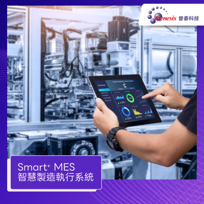
Genesis Technology Inc.
338
1
Smart Manufacturing
Genesis Smart⁺ MES
Integrated production management system covering 4M1E. Features real-time data collection, digital Kanban visualization, and full traceability. Enables paperless operations and complete process transparency.
1. Real-time Monitoring: Connects equipment signals to display WIP, utilization rates, and yield data instantly.
2. Traceability: Records comprehensive production lot numbers and process parameters for quality auditing.
3. Smart Scheduling: Optimizes production plans based on capacity constraints and order requirements.
TAIWAN SECOM CO., LTD.
5.60k
1
Smart Security
Fire notification + Emergency notification video device
Fire notification + Emergency notification video device
Taiwan Secom Technology Group launched a combination of 119 fire notification device and emergency notification image system, integrated anti-robbery, disaster prevention,and video, through real – timeimage monitoring and recording the scene, to grasp abnormal conditions; 24-hour control service center Line, monitor the signal for abnormality at any time ; if there is any abnormal information, it is immediately transmitted to the 119 and 110 service centers to reduce disaster expansion; the communication host has automatic detection function, and the control service center immediately dispatches personnel to overhaul when there is a failure; a test button , At any time to check whether the system is normal, and automatically fax back to the test status.
StarTrust System Inc.
2.28k
0
Net-Zero Consulting
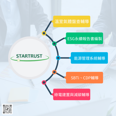
Sustainable consulting services
StarTrust System boasts a proficient team of consulting experts, each holding certifications in ISO 14064-1, ISO14067, ISO 50001, ISO 14001, SBTi, GRI Standard, and other relevant standards. We offer comprehensive guidance services encompassing greenhouse gas inventories (ISO 14064-1, GHG Protocol), carbon footprint assessments (ISO 14067), and advisory support for international initiatives such as CDP and SBTi. Additionally, we provide consultancy expertise in ESG report preparation, energy management, carbon neutral, and carbon reduction strategies.
To ensure data integrity, our consulting team at StarTrust System adopts systematic management practices. We meticulously organize activity documents, regulations, calculation parameters, and other pertinent data, ensuring timely updates to adhere to the latest regulations and calculation methodologies. Our approach mitigates complexities and minimizes the risk of errors in enterprise reporting operations.
Our services include:
1. Comprehensive guidance on ISO 14064-1, GHG Protocol, and related assessments.
2. Expert support for ISO 14067 product carbon footprint assessments.
3. Advisory services for implementing ISO 50001 energy management systems.
4. Analysis of carbon emission data reports.
5. Assistance with international initiatives such as CDP and SBTi.
6. Professional preparation of ESG sustainability reports.
Wave-In Communication
3.30k
1
Smart Manufacturing
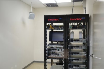
Inventec Smart Factory, System Integrated by Wave-In
With 5G private network system integration provided by Wave-In Communication, Inventec is transforming its Taoyuan Factory into a 5G smart factory, creating highly intelligent and automated production lines with AI and IoT capabilities.
Qualcomm Incorporated
460
0
Smart Security
Smart Recognition:On-device Vision-Language Model powered by Qualcomm Dragonwing™ IQ9
The Dragonwing IQ9 Series delivers industry leading AI performance, built in safety features, and design flexibility to meet the demands of advanced industrial workloads. Even in extreme environments, it provides high compute, power efficient processing for heavy, mission critical tasks.
The Dragonwing IQ9 series delivers up to 100 TOPS of on-device AI performance, capable of running Llama2 13B models and generating up to 12 tokens per second. Its industrial-grade safety features and ECC memory ensure stable and secure operation in harsh environments ranging from −40°C to +115°C, providing strong reliability for demanding deployments. Designed with developers in mind, it supports multiple operating systems, including the Qualcomm® Linux® software stack and Ubuntu, offering a flexible and accessible development environment. The platform is well suited for smart cities, large-scale security monitoring, traffic management, and other mission-critical applications.
*Qualcomm branded products are products of Qualcomm Technologies, Inc. and/or its subsidiaries. Qualcomm and Qualcomm Dragonwing are trademarks or registered trademarks of Qualcomm Incorporated.
SDS-System Design Service
488
0
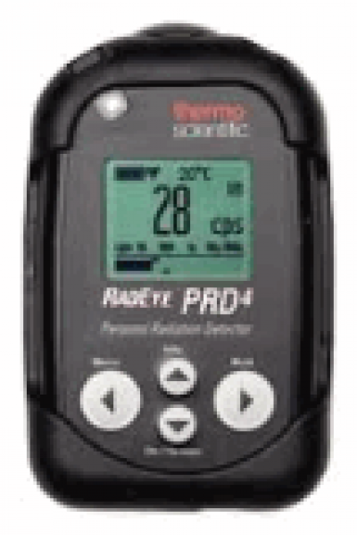
Smart Environmental Protection
TBox101 Radiation Monitor
TBox101 RadEye PRD-ER4 monitor
- Support dummy battery to provide 3V voltage for device power.
- Easy to change RadEye device mode at Wearable or Standalone.
- Read data from RadEye device through IR interface.
- Supports VGA port output for information display
- Supports data set and get operations on TBox101 via SNMP.
- TBox101 is powered through the USB port.
SYSCOM computer engineering Co.
4.90k
3
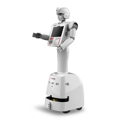
Smart Award
Smart Service Robot Ayuda
Smart service robot Ayuda is the latest fourth-generation robot released by Syscom Computer. Ayuda provides more convenient service functions for corporate and government customers. Ayuda is 100% Made in Taiwan (MIT) and integrates robot components, mobile platforms, facial recognition, human detection, voice recognition, voice and video chat, self-learning map search and navigation, and much more. Aydua stands above the competition. Syscom continuously analyzes expert knowledge and experience from many industrial sectors including policing, retail sales, banks, hospitals, large-scale exhibition spaces and events, government, and the public sector. Through AI robot services, we assist people and provide customized intelligent services. Ayuda is also working aborad, at CIJ Corporation of Japan, and has appeared on NHK TV, Kanagawa TV, and Shijiu News.
Product features
1. Customized hardware
2. Customized software
3. Ergonomic design that’s convenient for operation, allowing adults to easily operate
4. Primary functions include: indoor indexing navigation, facial recognition, voice chat, ticket printing, remote control, video conference, automatic charging, medical face mask detection, body temperature detection, product promotion, AI big data product recommendations, mobile payments, QR CODE scanning, slow signing and receiving medicine.

 、Firefox
  、Edge
、Edge  瀏覽器!
瀏覽器!